
Lecture
A cloud is suspended in the atmosphere products of condensation of water vapor, visible in the sky with the naked eye from the surface of Earth and near-Earth space. In a broad sense, a cloud is an accumulation of individual particles of some substance within a certain volume.
Clouds consist of tiny droplets of liquid water and/or crystals of water ice, called cloud elements. Droplet cloud elements are observed at air temperatures inside the cloud above −10 °C. At air temperatures inside the cloud from −15 to −10 °C, the cloud has a mixed composition (droplets and ice crystals). At air temperatures inside the cloud below −15 °C, the composition is purely crystalline. Water vapor is not the main component of clouds .
As cloud elements grow larger through condensation, their fall velocity increases. If the fall velocity of the cloud elements exceeds the velocity of the updraft, they rush toward the Earth's surface and may fall as precipitation, if they do not evaporate along the way. As a rule, precipitation falls from clouds that have a mixed composition at least in some layer (cumulonimbus, nimbostratus, altostratus). Weak drizzling precipitation (in the form of drizzle, snow grains, or light fine snow) can fall from clouds that are uniform in composition (droplet or crystalline) — stratus, stratocumulus.
Clouds play a key role in the Earth's thermal regime, increasing albedo (which promotes cooling) but also enhancing the greenhouse effect, thereby smoothing out diurnal and seasonal temperature fluctuations both on Earth as a whole and in individual large regions of the Earth.
Clouds are usually observed in the troposphere. Tropospheric clouds are subdivided into species, varieties, and additional features according to the international cloud classification. Occasionally other types of clouds are observed: nacreous clouds (at an altitude of 20—25 km) and noctilucent clouds (at an altitude of 70—80 km).
| Type | Genus |
|---|---|
| Convective clouds | Cumulus (Cumulus, Cu) Cumulonimbus (Cumulonimbus, Cb) |
| Wave clouds | Cirrocumulus (Cirrocumulus, Cc) Altocumulus (Altocumulus, Ac) Stratocumulus (Stratocumulus, Sc) |
| Ascending-glide clouds | Cirrus (Cirrus, Ci) Cirrostratus (Cirrostratus, Cs) Altostratus (Altostratus, As) Nimbostratus (Nimbostratus, Ns) |
| Turbulent-mixing clouds | Stratus (Stratus, St) |
Wave clouds form in anticyclones during inversions, when the lower boundary of the inversion coincides with the condensation level. At the boundary between warm, less dense (above) and cold, denser (below) air, air waves develop as the air moves. At their crests the rising air cools adiabatically — as a result of which clouds form in the shape of rolls and ridges. In the troughs of the waves the air descends, warming adiabatically and, consequently, moving away from the state of water-vapor saturation — as a result of which gaps of blue sky form.
Ascending-glide clouds form when warm and cold air masses meet. They arise as a result of the adiabatic cooling of warm air as it rises above cold air.
Turbulent-mixing clouds are the result of air being lifted as the wind strengthens, especially if fog is observed in the surface layers, which gradually transitions into stratus cloudiness.
| Families | Genus | Rain | Drizzle | Snow | Snow pellets | Hail | Height of cloud base |
|---|---|---|---|---|---|---|---|
| High-level clouds (at mid-latitudes, altitude — from 6 to 13 km) |
Cirrus (Cirrus, Ci) Cirrocumulus (Cirrocumulus, Cc) Cirrostratus (Cirrostratus, Cs) |
— — — |
— — — |
— — — |
— — — |
— — — |
7—10 km 6—8 km 6—8 km |
| Mid-level clouds (at mid-latitudes, altitude — from 2 to 6 km) |
Altocumulus (Altocumulus, Ac) Altostratus (Altostratus, As) |
— + |
— — |
— + |
— — |
— — |
2—5 km 2—6 km |
| Low-level clouds (at mid-latitudes, altitude — up to 2 km) |
Nimbostratus (Nimbostratus, Ns) Stratocumulus (Stratocumulus, Sc) Stratus (Stratus, St) |
+ + — |
— — + |
+ + + |
— + — |
— — — |
0.5—1.9 km 0.5—1.5 km 0.03—0.4 km |
| Clouds of vertical development | Cumulus (Cumulus, Cu) Cumulonimbus (Cumulonimbus, Cb) |
+ + |
— — |
+ + |
+ + |
— + |
0.6—1.2 km 0.6—1.2 km |
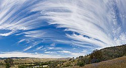
Cirrus clouds (Victoria, Australia)
They consist of separate feather-like elements in the form of thin white filaments or white (or mostly white) patches and elongated ridges. They have a fibrous structure and/or a silky sheen. They are observed in the upper troposphere, sometimes at the altitudes of the tropopause or directly beneath it (at mid-latitudes their bases most often lie at altitudes of 6—8 km, in the tropics from 6 to 18 km, at the poles — from 3 to 8 km above sea level). Visibility inside the cloud is 150—500 m. They consist of ice crystals large enough to have a noticeable fall velocity. Therefore cirrus clouds have considerable vertical extent (from hundreds of meters to several kilometers). However, wind shear and differences in crystal size cause the filaments of cirrus clouds to be slanted and curved. Cirrus clouds usually do not produce well-defined halo phenomena because of their fragmented structure and the small size of individual cloud formations. These clouds are typical of the leading edge of the cloud system of a warm front or occluded front associated with ascending glide. They also often develop under anticyclonic conditions, sometimes being parts or remnants of the ice tops — anvils — of cumulonimbus clouds. The appearance of cirrus clouds at sunset is a common occurrence during a sharp rise in temperature, when there is no precipitation in the long-range forecast .
Subspecies of cirrus clouds are distinguished: fibratus (Cirrus fibratus, Ci fibr.), uncinus (Cirrus uncinus, Ci unc.), castellanus (Cirrus castellanus, Ci cast.), spissatus (Cirrus spissatus, Ci spiss.), floccus (Cirrus floccus, Ci fl.), and varieties: intortus (Cirrus intortus, Ci int.), radiatus (Cirrus radiatus, Ci rad.), vertebratus (Cirrus vertebratus, Ci vert.), duplicatus (Cirrus duplicatus, Ci dupl.).
Sometimes this genus of clouds, alongside the ones described, also includes cirrostratus and cirrocumulus clouds.
They are often called «mackerel sky» for their visual resemblance to a flock of white sheep. Very high, small, globular clouds arranged in lines. They resemble the backs of mackerel or ripples on beach sand. The height of the lower boundary is 6—8 km above sea level, the vertical extent is up to 1 km, visibility inside the cloud is 200—500 m. They are a sign of rising temperature. They are often observed together with cirrus or cirrostratus clouds. They are frequently precursors of an approaching storm. In these clouds, so-called «iridescence» is observed — rainbow-like coloring at the cloud edges. They show no shading, even on the side turned away from the sun. They form when wave and ascending motions arise in the upper troposphere and consist of ice crystals. Halos and coronas around the sun and moon can be observed in cirrocumulus clouds. No precipitation falls from them.
Species are distinguished: undulatus (Cirrocumulus undulatus), lenticularis (Cirrocumulus lenticularis), cumuliformis (Cirrocumulus cumuliformis), floccus (Cirrocumulus floсcus).
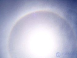
A halo formed on cirrus clouds
Sail-like high-level clouds. They consist of ice crystals. They have the appearance of a uniform, whitish veil. The height of the lower edge is 6—8 km above sea level, the vertical extent ranges from several hundred meters to several kilometers (2—6 or more), visibility inside the cloud is 50—200 m. Cirrostratus clouds are relatively transparent, so that the sun or moon can be clearly seen through them. These high-level clouds usually form when extensive layers of air rise due to multi-level convergence.
Cirrostratus clouds are characterized by frequently producing halo phenomena around the sun or moon. Halos result from the refraction of light by the ice crystals that make up the cloud. Cirrostratus clouds, however, tend to thicken as a warm front approaches, which means an increase in ice-crystal formation. As a result the halo gradually disappears, and the sun (or moon) becomes less distinct.
The following subspecies are distinguished: fibratus (Cirrostratus fibratus), nebulosus (Cirrostratus nebulosus).
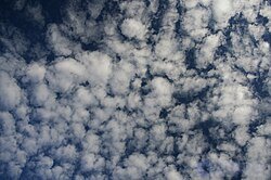
Formation of altocumulus clouds
Altocumulus clouds (Altocumulus, Ac) — typical cloudiness for the warm season. Gray, white, or bluish clouds in the form of waves and ridges composed of flakes and plates separated by gaps. The height of the lower boundary is 2—6 km, the vertical extent is up to several hundred meters, visibility inside the cloud is 50—80 m. They are usually located over places facing the sun. They sometimes reach the stage of towering cumulus clouds. Altocumulus clouds usually arise as a result of the lifting of warm air masses, and also with the approach of a cold front, which pushes warm air upward. Therefore the presence of altocumulus clouds on a warm, humid summer morning foretells the imminent arrival of thunderstorm clouds or a change in weather.
They have the appearance of a uniform or faintly wavy veil of gray or bluish color. The sun and moon usually show through, but faintly. The height of the lower boundary is 3—5 km, the vertical extent is 1—4 km, visibility in the clouds is 25—40 m. These clouds consist of ice crystals, supercooled water droplets, and snowflakes. Altostratus clouds can bring continuous rain or snow.
Altostratus translucidus clouds. The wavy structure of the cloud is noticeable, the solar disk is quite discernible. Fairly distinct shadows may sometimes appear on the ground. Bands are clearly visible. The veil of clouds, as a rule, gradually covers the entire sky. The height of the base is within 3—5 km, the thickness of the As trans cloud layer averages about 1 km, occasionally — up to 2 km. Precipitation falls, but at low and middle latitudes in summer it rarely reaches the ground.
Nimbostratus clouds are dark gray, forming a continuous layer. During precipitation the layer of nimbostratus clouds looks uniform; in the breaks between precipitation events a certain non-uniformity and even some waviness of the layer is noticeable. They differ from stratus clouds by their darker, bluer color, the non-uniformity of their structure, and the presence of continuous precipitation. The height of the lower boundary is from 100 to 1900 m, the thickness — up to several kilometers.
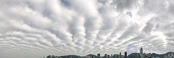
Stratocumulus clouds
Gray clouds consisting of large ridges, waves, and plates separated by gaps, or merging into a continuous gray wavy cloud layer. They consist mainly of water droplets. The height of the lower boundary is usually within the range of 500 to 1800 m. The thickness of the layer is from 200 to 800 m. The sun and moon can shine through only at the thin edges of the clouds. Precipitation, as a rule, does not fall. Weak, short-lived precipitation may fall from non-translucent stratocumulus clouds.
Stratus clouds form a uniform layer similar to fog, but located at some altitude (most often from 100 to 400 m, sometimes 30–90 m). They usually cover the entire sky, but sometimes they may be observed in the form of ragged cloud masses. The lower edge of these clouds can descend very low — sometimes they merge with ground fog. Their thickness is small — tens and hundreds of meters. Sometimes precipitation falls from these clouds, most often in the form of snow grains or drizzle.
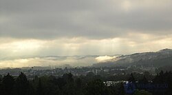
Foggy stratus clouds |
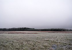
Stratus clouds |
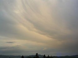
Nimbostratus clouds and strong air currents |
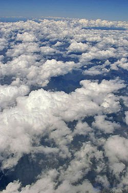
Cumulus clouds. Top view
Cumulus clouds — dense, brilliant white clouds by day with considerable vertical development. The height of the lower boundary is usually from 800 to 1500 m, sometimes — 2—3 km or more. The thickness is 1—2 km, sometimes — 3—5 km. The upper parts of cumulus clouds have the appearance of domes or towers with rounded outlines. Cumulus clouds usually arise as convective clouds in cold or neutral air masses.
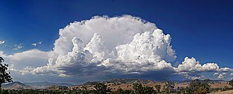
Cumulonimbus clouds (Cumulonimbus capillatus incus)
Cumulonimbus — powerful and dense clouds with strong vertical development (several kilometers, sometimes up to a height of 12—14 km), producing abundant shower precipitation with thunderstorms and sometimes strong hail. Cumulonimbus clouds develop from powerful cumulus clouds. They can form a line called a squall line. The lower levels of cumulonimbus clouds consist mainly of water droplets, while at higher levels, where temperatures are far below 0 °C, ice crystals predominate. The height of the lower boundary is usually below 2000 m, that is, in the lower layer of the troposphere.
|
Cloud movement. Video |
Cloud movement. Video |
Noctilucent clouds form in the upper layers of the atmosphere. These clouds are located at an altitude of about 80 km. They can be observed immediately after sunset or before sunrise. Noctilucent clouds were discovered in the 19th century, which may possibly be related to the increased role of human activity.
Noctilucent clouds also formed after the fall of the Tunguska meteorite, forming a developed morphological structure with wave formations from 3 to 300 km long.
Nacreous clouds form in the stratosphere (at altitudes of about 20—30 km) and consist of ice crystals.
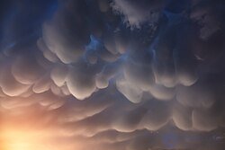
Mammatus clouds in the Himalayas
Mammatus (also tubular, pouch-like) clouds — clouds whose base has a specific cellular or pouch-like shape. They occur rarely, mostly in hot weather, and are associated with the development of cumulonimbus clouds — with low humidity in the sub-cloud layer and a significant change in wind speed with height near the level of the cloud base.
Lenticular (lens-shaped) clouds form on the crests of air waves or between two layers of air. A characteristic feature of these clouds is that they do not move, no matter how strong the wind is. The airflow sweeping over the Earth's surface flows around obstacles, and air waves form as a result. They usually hang on the leeward side of mountain ranges, behind ridges and individual peaks at altitudes from 2 to 15 km.
Pyrocumulus clouds, or pyrocumulus — convective (cumulus or cumulonimbus) clouds caused by a large fire or volcanic activity. These clouds got their name because the fire or the erupting volcanic lava heats the air directly above it and thereby creates convective updrafts, which, as they rise and reach the condensation level, lead to the formation of clouds — first cumulus, and under favorable conditions — cumulonimbus as well. In this case thunderstorms are possible — lightning strikes from this cloud often cause new fires.
The first direct observers of clouds were aeronauts who ascended in hot-air balloons (that is, from the end of the 18th century). They established the fact that all observed cloud forms fall, by their structure, into two groups:
Thanks to balloon ascents and observations made while climbing mountains, another fact was established: the structure of clouds of the first group, when an observer is surrounded by such a cloud on all sides, is no different from ordinary fog observed near the Earth's surface. What appeared to an observer below to be clouds hanging on a mountain slope or at some altitude in the atmosphere, appeared to an observer who found himself inside such a cloud to be fog. Since the time of Halley and Leibniz it had already been known and confirmed by direct observation that individual particles of fog, and consequently of clouds, have a spherical shape. To explain why these spheres remain suspended in equilibrium in the air, a hypothesis was proposed that these spherical fog particles consist of air bubbles surrounded by an extremely thin water shell (called vesicules, as such bubbles were named); given sufficient bubble size and a sufficiently thin shell (a calculation made by Clausius showed that the thickness of the water shell should be no more than 0.0001 mm), the resistance of the air to their fall should be so significant that the fall of vesicules could proceed very slowly, so that they would appear to float in the air, and with the slightest updraft their fall could even turn into an upward motion. This hypothesis became widespread after Clausius, basing himself on the supposedly extraordinarily thin water shell of the vesicules, managed to explain the blue color of the sky.
Alongside the vesicular hypothesis there was another opinion, which held that the water spheres of fogs consisted entirely of liquid water. The difficulty of examining water spheres under a microscope meant that such observations of them were made in a sufficiently reliable form only in 1880, when Dines, for the first time observing the water spheres that make up fogs in England, concluded that the fog particles he observed were in fact genuine droplets of water, whose sizes ranged from 0.016 to 0.127 mm. Later, similar observations were made by Assmann on the summit of the Brocken, which — especially in the cold season — lies in the zone of most active formation of clouds of various shapes, forming now somewhat above, now slightly below, now exactly at its altitude. Assmann became convinced that all the cloud forms containing liquid water that he observed consist of genuine droplets, whose sizes vary between 0.006 mm (in the upper parts of the clouds) and 0.035 mm (in its lower parts). These droplets were observed to remain liquid even at a temperature of −10°C; only upon touching some solid body (for example, a microscope slide) did they instantly turn into ice needles. Finally, Obermayer and Budde showed that, proceeding from capillary phenomena, the existence of vesicules could not be admitted. Thus this hypothesis passed into history. Stokes' research and calculations made by Maxwell proved that a weak upward current, rising at a speed of no more than 0.5 meters per second, is sufficient to stop the fall of water droplets. Regarding the second group of clouds, which usually form at great altitudes — such as cirrus and cirrostratus — observations made by aeronauts showed that these forms consist exclusively of water in the solid state. Myriads of ice crystals and needles, similar to those often observed in the lower layers of the atmosphere falling on quiet, frosty winter days — often even under a cloudless sky — forming regular hexagonal plates or six-sided prisms ranging from microscopically small to visible to the naked eye, remain suspended in the upper layers of the atmosphere, sometimes forming individual filaments or feathery tufts, sometimes spread as a uniform layer over large areas, giving the sky a whitish tint in cirrostratus cloudiness .
For clouds to form, the transition of vapor into a liquid-droplet state is necessary. However, theoretical research by Bezold, based on experiments by Aitken, showed that this transition is a rather complex phenomenon. Through very ingenious experiments Aitken established that mere cooling of air masses below the temperature of their saturation with water vapor is not by itself sufficient for the vapor to pass into a liquid-droplet state: for this the presence of at least the tiniest solid particles is necessary, on which the vapor condensing into liquid begins to collect into droplets. When air saturated with water vapor is completely clean, the vapors, even after passing through the saturation temperature, do not, however, turn into liquid, remaining supersaturated. Certain gaseous substances, such as ozone and nitrogen compounds, can also contribute to the formation of water droplets. That solid bodies indeed play a role in cloud formation could already be seen from observations that established the existence of dirty rains. Finally, the extremely bright sunsets observed following the eruption of the Krakatoa volcano in 1883 showed the presence of the tiniest particles of dust ejected by the eruption at very great altitudes. All this explained the possibility of microscopically small dust particles being lifted very high into the atmosphere by strong winds, and the opinion of Aitken and Bezold regarding the necessity of the presence of solid particles for cloud formation received confirmation .
In the early 1930s, at the Leningrad Institute of Experimental Meteorology (LIEM), under the direction of V. N. Obolensky, experimental and theoretical work on the study of clouds was begun. In March 1958, on the initiative of N. S. Shishkin, an independent «Department of Cloud Physics» was created at the A. I. Voeikov Main Geophysical Observatory .
With the aim of studying the Earth's cloud cover and the formation and «evolution» of clouds, NASA launched two specialized satellites, CloudSat and CALIPSO, in 2006.
In April 2007, NASA launched into polar orbit the AIM satellite (The Aeronomy of Ice in the Mesosphere), intended for the study of noctilucent clouds.
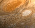
Jupiter's cloud cover.
Besides Earth, clouds are observed on all the giant planets, on Mars, Venus, Titan, Triton and, probably, on Pluto . The observed extraterrestrial clouds have varying nature and chemical composition. For example, on Venus the most massive cloud layer consists predominantly of sulfuric acid. Titan's clouds consist of methane, and methane precipitation falls from them at a temperature of −180°C, similar to how on Earth water clouds are sources of water rain during the warm season.
Data on clouds on exoplanets is already available
According to the phase state of the cloud elements, all clouds are divided into three classes:
Water (droplet) clouds — exist at above-zero and below-zero temperatures (down to −10 degrees)
Mixed clouds consist of supercooled droplets or ice crystals
(from −10 to −40)
Ice (crystalline) clouds exist at temperatures below −40 °C.
In the warm season, water clouds form mainly in the troposphere (in the lower layers), mixed clouds — in the middle layers, ice clouds — in the upper layers. In a unit volume of air (1 m3) there is from 0.01 g to 3 g of water; in crystalline clouds even less (hundredths and thousandths of a gram). The absolute humidity of the air equals several grams, and in higher layers, that is, at lower temperatures – a few tenths of a gram. During condensation, not all the water vapor turns into the liquid state, only part of it. Therefore the liquid water content of clouds turns out to be less than the absolute humidity.
An international classification of clouds and their main forms has been developed, including in particular: cirrus, cirrocumulus, cirrostratus, and others.
The degree of coverage of the sky by clouds is often called cloudiness, and cloudiness is usually expressed in tenths (oktas on a ten-point scale). The ten-point system (0 — clear, 10 — overcast). When choosing average values, it is permissible to indicate tenths of a unit. Cloudiness is usually determined visually or by special instruments.

Comments